Cities: Skylines

Cities: Skylines

Not enough ratings
How To Make Height Map in PS [Easiest Way to Create a Map]
By OWL
   
Award
Favorite
Favorited
Unfavorite
Preparation
  • Open a new file [2048x2048]
  • Go to Edit > Preferences > Guides, Grid & Slices
  • Set things up like the image below:


    This will give you 81 tiles view in-game

  • Paint the Background black

  • Go to View > Show > Grid [check]
  • Under the same Tab, make sure Snap is ON
  • Create a New Layer, then draw 25 or 9 Tiles zone using the Line Tool [If you like] It will be easy while Snap is ON


Drawing & Final Settings
  • Create another New Layer. Choose Lasso Tool and start drawing your selection borders.

    MAKE SURE SNAP is OFF

    You dont have to draw them in one piece. Draw some. Finish it. HOLD SHIFT (Will add to the previous selection) and draw. If you did a mistake, simply HOLD ALT and draw again on your selection however and whereever you wanna remove

  • Once you are done, take the Paint Bucket Tool and paint the selection 100% White


  • Duplicate the Layer and drag the copy below the original. We'll make smooth underwater levels.

  • Use Fx > Outer Glow for Duplicated Layer.


  • Make it white/gradient and play with knobs however you like.
  • Right Click on the Layer and Rasterize it. It will collapse the effect and the image.
  • Use Gaussian Blur on it. [[b]Filter
[/b] > Blur > Gaussian Blur] It will smooth the Outer Glow.


  • Then hit Levels under Adjustments Panel and pull the White down to the Output: 15 [15 ill give you a height around 60 meters in-game]


    MAKE SURE LEVELS PANEL UPON BOTH OF YOUR BASE LAND LAYERS. IT AFFECTS THE LAYERS UNDER.
  • Save it as PNG into your Heightmap folder and import.

    IT WILL SAVE YOUR TIME AND ALLOW YOU TO SEE WHOLE PICTURE OF THE MAP.

    ENJOY.
  • [/list]
    1 Comments
    Havan_IronOak 14 Sep, 2016 @ 7:26am 
    Great guide! I'm pretty much a map creation newbie but I have used photoshop for years. (Just not the tools you're focusing on here)

    As you know Terrain Party has the ability to pull in real life height maos. I imported one for San Fransico and spent ages smoothing it in-game.

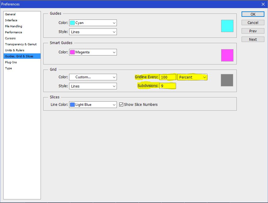
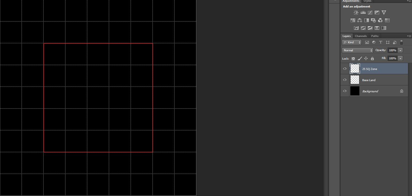
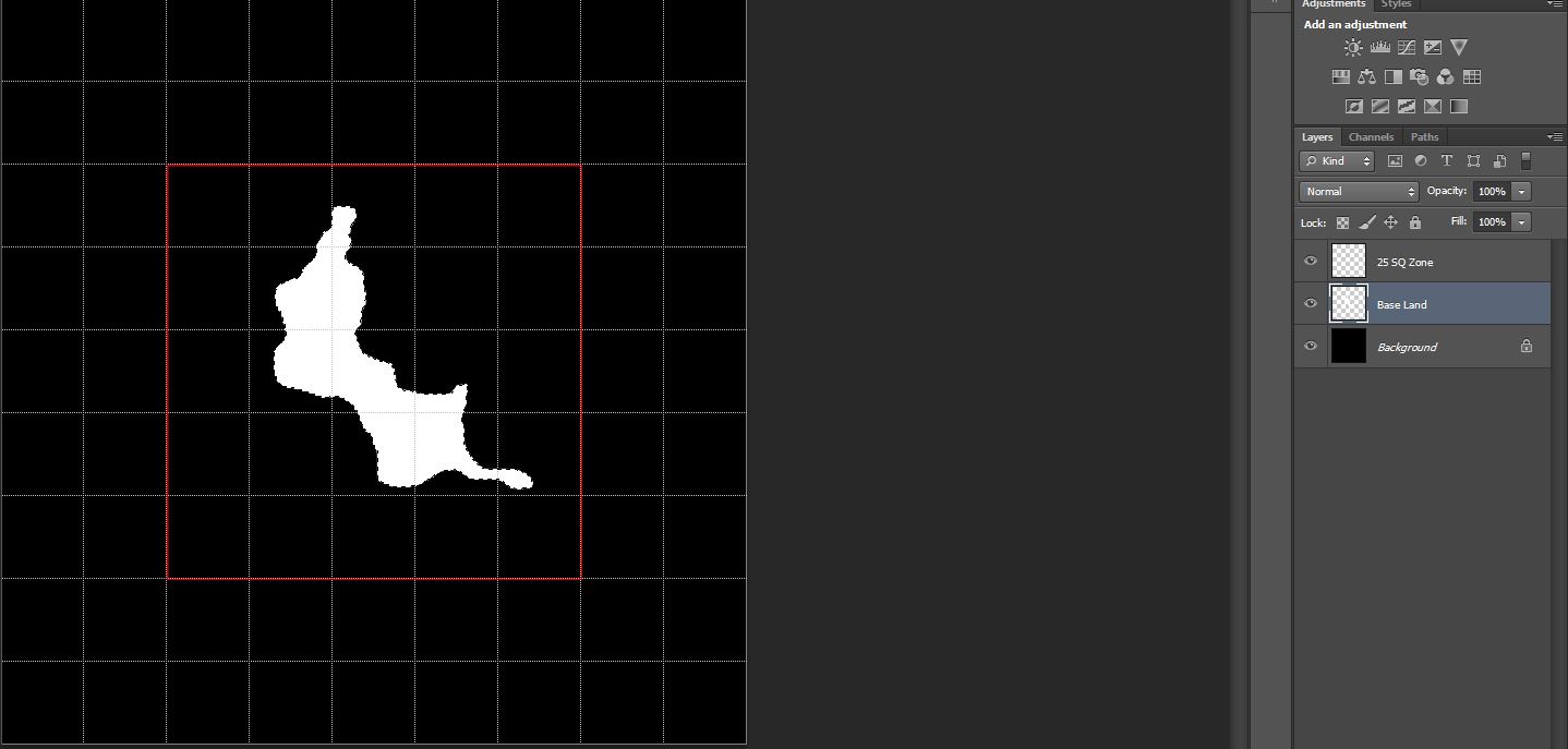
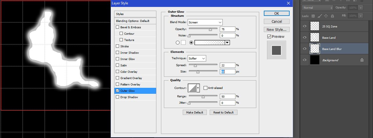
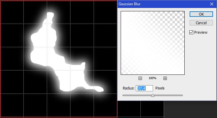
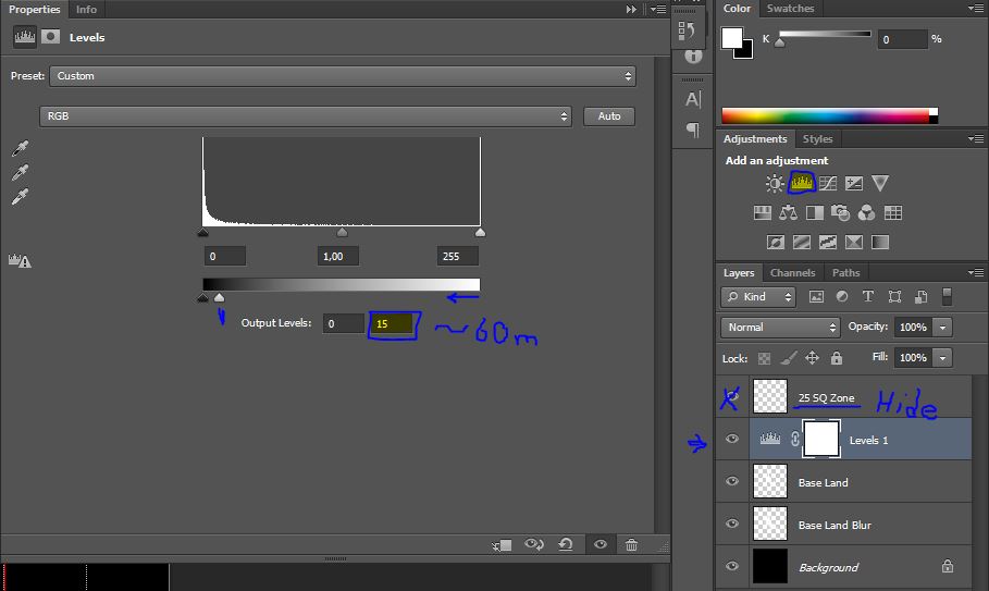
    Can you offer some advice about how one could use photoshop tools to clean up the worst excesses in an imported height map, or is it as hopelessly complicated as it felt when I first tried to play with these maps in PS?

    I was also trying to use an imported google maps image to spot all water features on the map and get them all added into the height map in one fell swoop but that was a total failure.